01 / 10
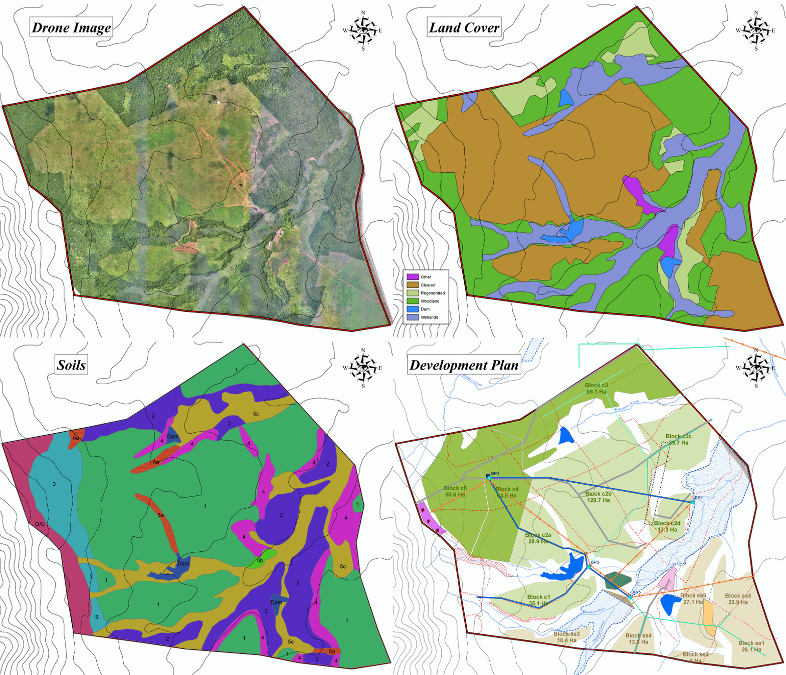
Resource Assessment
Assessing water resources and land potential to inform practical development planning.
Project gallery
Selected applications across water, agriculture, mapping and remote sensing.
Project capability
01 / 10
Assessing water resources and land potential to inform practical development planning.
02 / 10
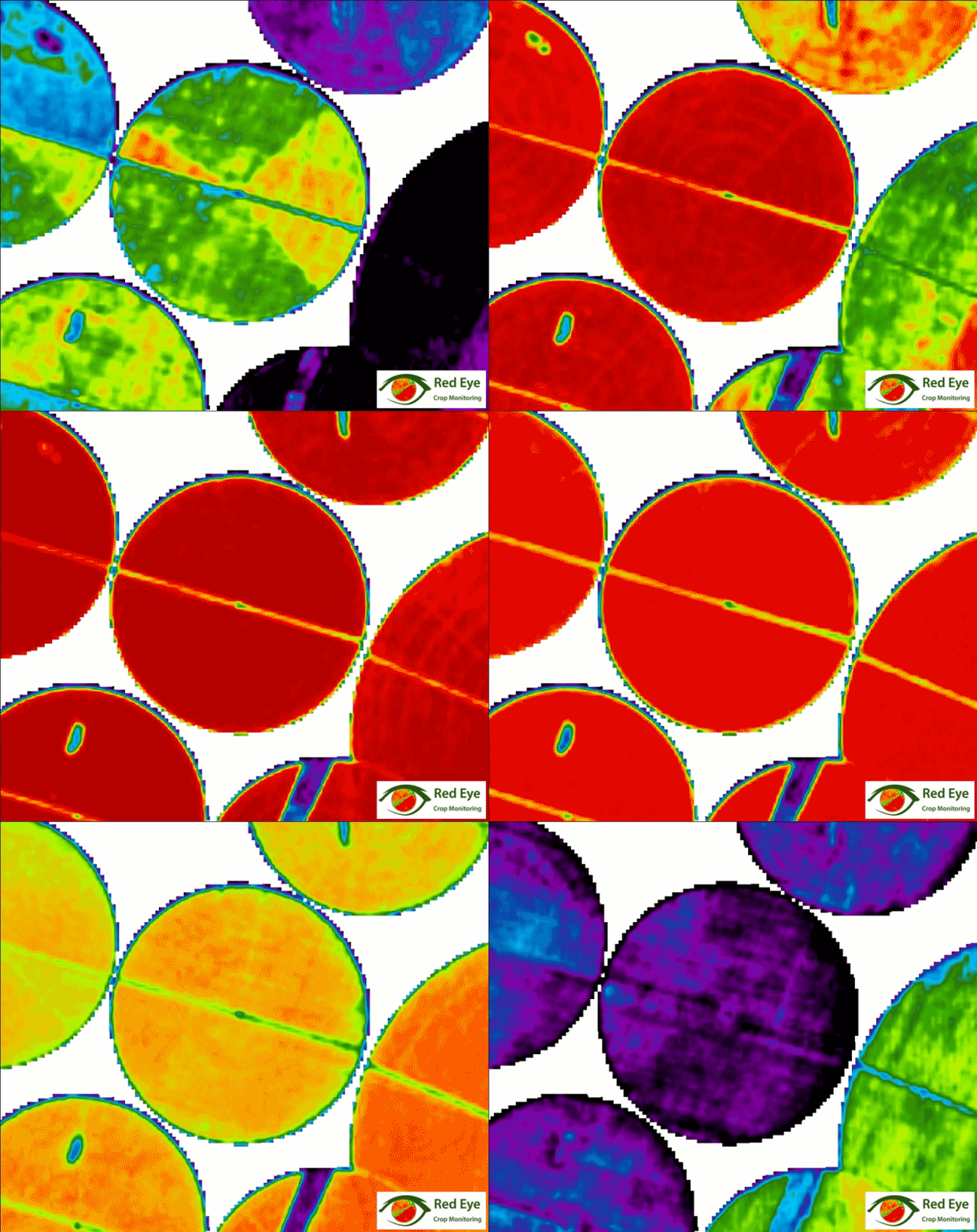
Time-series multispectral imagery reveals crop health, uniformity and areas for improvement.
03 / 10
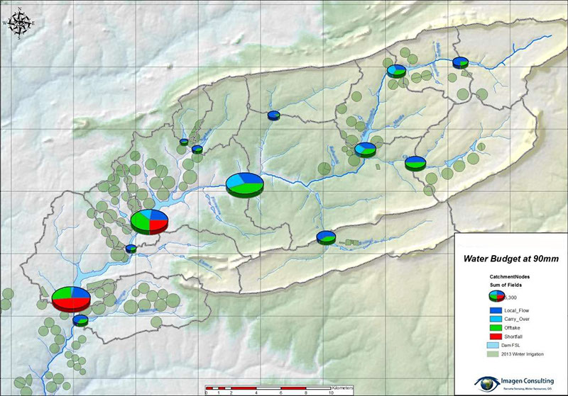
Catchment-wide assessment supports reliable supply forecasts and equitable water management.
04 / 10
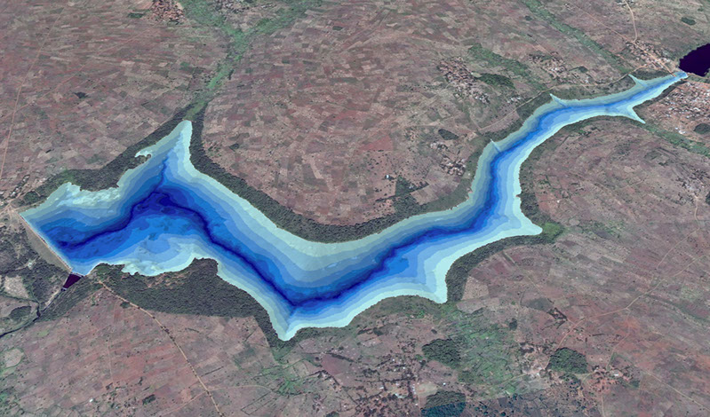
River and reservoir surveys support water audits, bed modelling and sediment analysis.
05 / 10
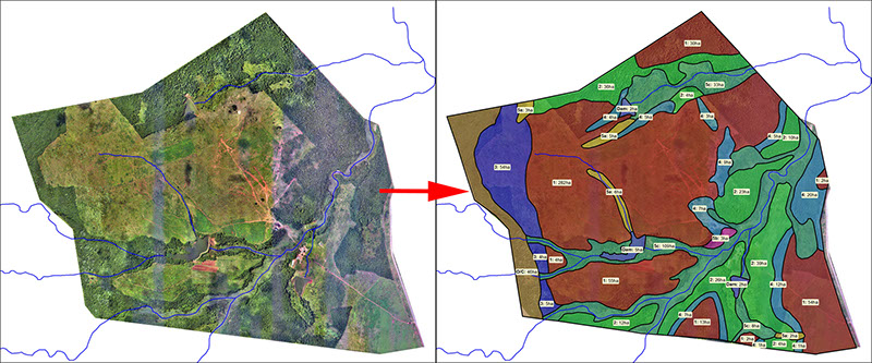
Satellite imagery and field analysis identify soil types and properties.
06 / 10
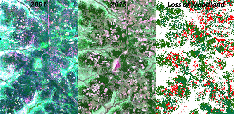
Satellite time series quantify land-cover change and deforestation.
07 / 10
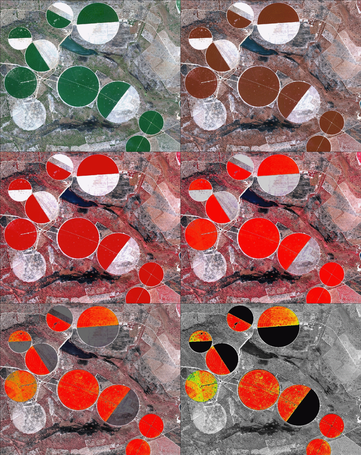
Near-infrared and NDVI analysis provides accurate, non-destructive crop and ground-cover insight.
08 / 10
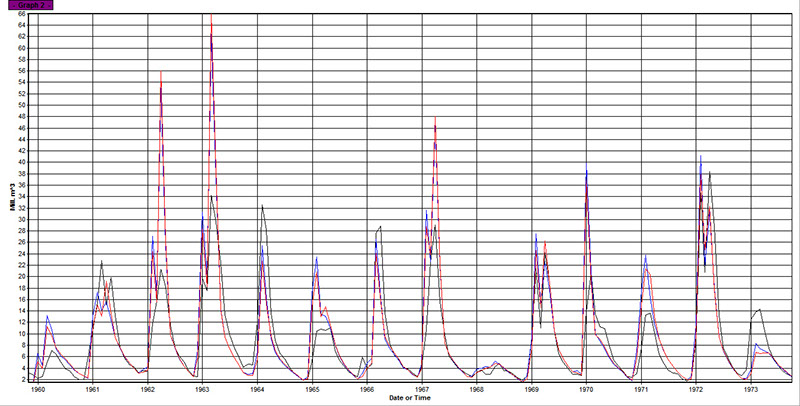
Rainfall-runoff modelling provides meaningful forecasts in data-scarce areas.
09 / 10
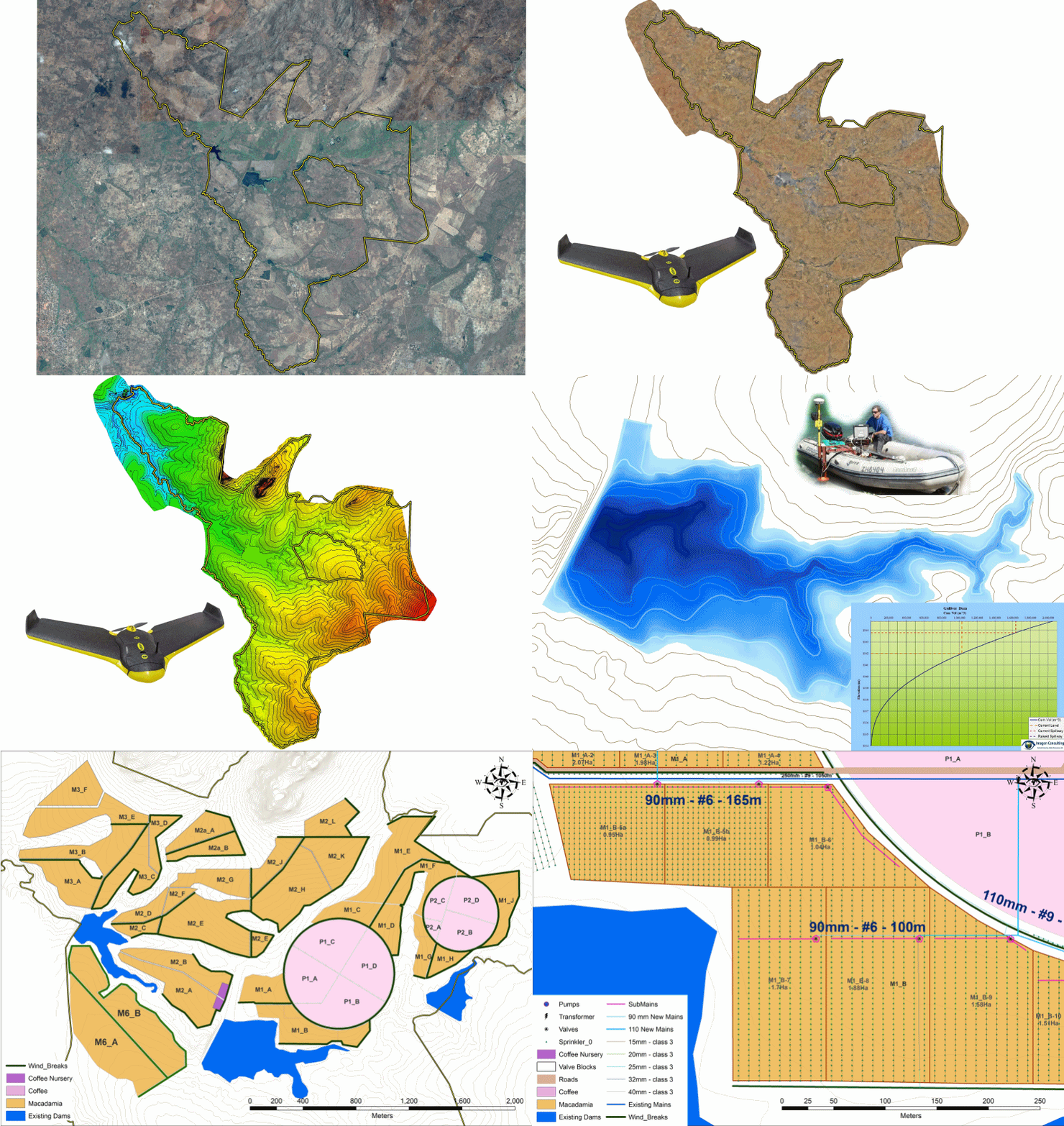
Drone, sonar and field data combine into comprehensive resource assessments and irrigation designs.
10 / 10
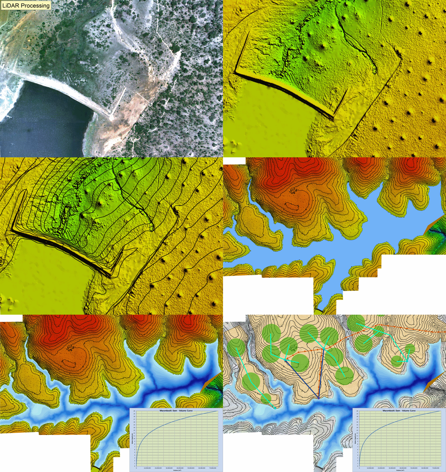
High-accuracy elevation models support hydro-engineering, planning and implementation.
Project 1 of 10